
Find Youngstown Street Directory Results
A street search in Youngstown works best as a record trail, not as a claim about every person connected with an address. Start with the Mahoning County Auditor Property Search to locate the parcel. Its instructions permit a whole-street result when both house-number boxes are blank and the street name is entered without the street-type word. Open each green parcel number separately. Save the parcel number, situs, legal description, acquisition information, and the date you searched before moving on.
- Enter the street name in the Auditor address search with both house-number fields blank. Use a low and high number only when a defined range is needed.
- Open the parcel card and distinguish the property situs from the deeded-owner and tax-payer correspondence fields.
- Use the parcel number in Mahoning GIS to view the mapped parcel and road context, then inspect each address record on its own merits.
- Carry the current owner, acquisition date, and legal description to the Recorder for recorded-document research by party or document details.
- For a dated household clue, consult a selected reverse directory and then its alphabetical companion at PLYMC or MVHS.
Ohio voter tools are for individual registration verification, not open street browsing. The statewide search requires a first name, last name, and county, while protected registration data remains closed under Ohio law. This order keeps a Youngstown street directory search tied to the record systems that are actually keyed to an address.
Search Youngstown Streets in the Auditor
The Auditor portal is the strongest starting point for a current Youngstown street directory search because its basic modes accept owner, parcel, or address and its advanced modes add sales, locations, and property types. Partial entries broaden results. The official guide says to omit Street, Drive, Lane, and similar type words from the street-name field. Parcel numbers can be supplied with or without dots or dashes, and advanced results can export to CSV. These results describe assessed real estate, not a private household roll.
| Auditor field | Use on a street search | Format note |
|---|---|---|
| House # / House # High | One address, a range, or the entire street | Leave both blank for a whole-street result. |
| Street Name | Required address key | Enter the name without its type word. |
| Parcel Number | Opens one tax-map record | Full zeroes are advised; dots and dashes work. |
| Owner Name | Checks recorded ownership names | Partial last name or last name plus first initial is accepted. |
| Sale dates and buyer/seller | Refines a transfer search | Optional advanced criteria. |
The Mahoning County Auditor is also available at 120 Market Street, first floor, Youngstown, weekdays from 8:00 a.m. to 4:30 p.m. Its counter is the fallback for help interpreting the current appraisal and tax system when a portal field or export does not answer the question.
Note: The whole-street query is a parcel result set, so each property record still needs individual review.
Read Youngstown Street Directory Fields
Three address-like fields can point in different directions on a parcel card. The property location, also called the situs, identifies the taxable real estate. The deeded-owner address reflects the last recorded document's owner address. The tax-payer address is where tax correspondence is mailed. A Youngstown street directory result should never turn one of those mailing fields into a statement that someone currently lives at the property.
- Parcel
- The tax-map unit used to connect the Auditor record, map geometry, and related property data.
- Situs address
- The physical location assigned to the property for tax and mapping purposes.
- Plat
- A recorded map that can describe lots, blocks, streets, and subdivision layout.
- Criss-cross directory
- A reverse directory that begins with an address and points to a directory-listed name for a particular edition.
A typical Auditor record also supplies valuation history, sales, legal description, improvements, taxes, special assessments, a sketch, and a GIS handoff. Record the field label exactly as shown. That preserves the narrow meaning of a sale, blank value, or correspondence address.
Map Youngstown Streets in Mahoning GIS
Mahoning County GIS and Tax Map is the spatial companion to the parcel card. Its viewer supports global search for a place, address, parcel ID, or keyword. Identify, layer search, map browse, parcel-report, measure, print, export, and share tools help place a record along a Youngstown street. The published cadastral layers show parcel IDs, lot IDs, road frontage, boundaries, and tax-district context.
The official GIS launch screen is shown below from the Mahoning GIS viewer.
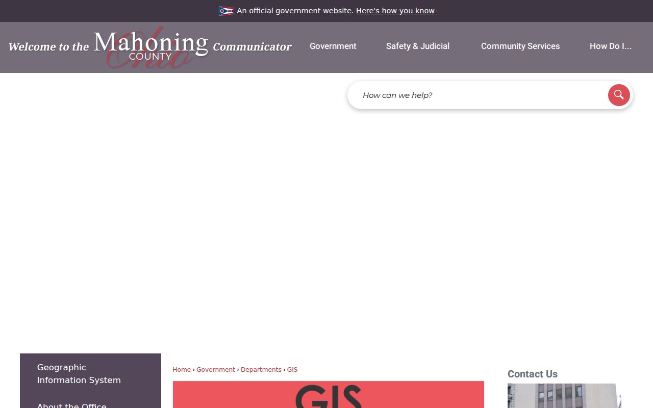
Use the map to understand context, then open the matching parcel card for the ownership and tax fields. Mahoning County describes the viewer as informational, so property lines on screen do not establish a legal survey boundary.
Note: Map-adjacent parcels show spatial context, not a confirmed list of people connected with each address.
Move From Youngstown Streets to AVA
A street address is not an AVA search field. The Mahoning Recorder AVA search enables party name, document number, book and page, reference number, and subdivision name or lot and block. Address, parcel, municipality, and tract modes were disabled in the inspected setup. That limitation is useful: get the legal description and party information from the Auditor first, then search the recorded-document index with those facts.
| AVA mode | What to bring from the parcel trail | What the result can show |
|---|---|---|
| Party name | Current or prior owner spelling and date range | Parties, document type, number, and recorded date. |
| Book / page | Historic placement citation | Recorded-document route for an earlier instrument. |
| Subdivision / lot / block | Legal-description elements | Subdivision-based document context. |
The following Recorder AVA screen comes from the official AVA search.
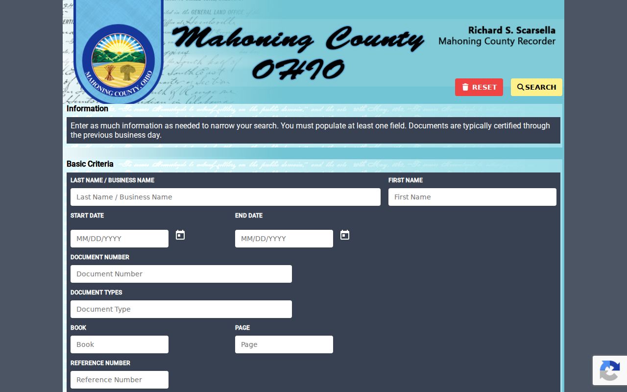
Record the grantor, grantee, document type, recording date, document number or book and page, and legal description exactly. Public image viewing was disabled in the inspected configuration, so an index hit may still require the Recorder's access routes for a copy.
Check Youngstown Street Permit Dates
For a building-change timeline, the Mahoning County Permit Inquiry Manager accepts address, owner, parcel, lot, permit number, and partial street-name routes. Its Permit Type choices include building, certificate of occupancy, demolition, mechanical, and property maintenance. Results can show the house number, street, permit number and date, owner, lot, parcel ID, and project. Status refreshes nightly at 3 a.m.
The official permit inquiry screen is available through the County permit system.
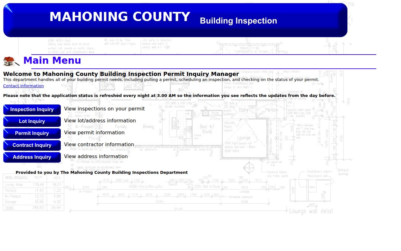
A permit proves a recorded project or inspection action, not a current household connection. For older material, Building Inspection accepts a specific written public-record request at 330-270-2894; its form states copying or faxing costs $0.10 per page plus mailing and requests payment before release.
Note: Permit search results should be read as building evidence and kept separate from property ownership evidence.
Compare Youngstown Street Record Sources
Each source answers a different question along a Youngstown street. The parcel identifier is the bridge between the current property system, GIS, and a deed trail. A street name is useful for the Auditor and Permit Inquiry Manager, but the Recorder AVA is deliberately party and document based. Use the source that matches the key it actually keeps.
| Address record | Youngstown custodian | Best use | Access path |
|---|---|---|---|
| Parcel card | County Auditor | Current parcel, situs, legal description, sales | Portal or Auditor counter |
| GIS parcel map | GIS / Tax Map | Road, lot, parcel, and layer context | Public viewer, 330-740-2455 |
| Recorded instruments | Mahoning Recorder | Transfer and legal-description chain | AVA, Laredo, or public terminals |
| Permit and inspection files | Building Inspection | Work, demolition, and alteration chronology | Inquiry Manager or specific request |
| Reverse directories | PLYMC and MVHS | Dated address-to-name clue | Catalog, shelves, and local-history help |
The Recorder offers free Laredo Anywhere signup by mail, fax, or in person. Its office at 120 Market Street has 13 public computers, and pre-1985 records are viewed during office hours. Staff do not conduct the search for a requester, so bring a known party name, date, or legal-description detail.
Use Youngstown Street Numbering Carefully
Youngstown's Chapter 917 follows a Philadelphia Plan of 100 numbers per square. East-west streets crossing Market Street or Wick Avenue number from the intersection, with odd numbers south and even numbers north. North-south streets between Fifth and Himrod use Federal Street, while other north-south streets use the stated Mahoning or Himrod references. Remaining streets generally number from the end leading from Central Square.
This numbering rule is a present address-reading aid. It does not prove that an old directory used the same form. For a historic result, compare the address with its lot or legal description, the directory street index, and a dated map before carrying it backward.
The GIS Viewer Help documents the search, identify, layers, and parcel-report tools used to make those comparisons.
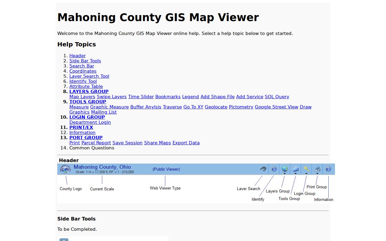
The help material reinforces the useful division of labor: map and identify the parcel first, then rely on the custodian record for the field being checked.
Read Historic Youngstown Street Directories
Reverse or criss-cross directories are the historical address-to-name layer for a Youngstown street directory search. They are held for selected later years, so confirm the particular title and edition at the Public Library of Youngstown and Mahoning County or Mahoning Valley Historical Society. Use an address result to find the name in the alphabetical volume, then compare its occupation or notation and inspect nearby editions for a move or change.
The digitized 1886-87 N. H. Burch & Co. volume is a clear example of why the edition matters. It includes a street directory and an abbreviation key, while its late changes appear in a separate Too Lates, Alterations and Removals section. A directory line is dated publisher evidence, not proof of an exact move date or an entire household.
Note: PLYMC's Book-a-Librarian route is appropriate for a focused address, era, and named source request.
Respect Youngstown Street Directory Limits
A parcel map is not a household roster. Mahoning GIS identifies property geometry and the Auditor identifies administrative property fields, but neither reports private household membership. AVA records transactions and legal descriptions, not a current presence at a home. Ohio voter law also withholds Social Security numbers, driver or state identification numbers, phone and email data, confidential registrations, and other protected classes. Safe at Home participants have special address protection.
Lawful use. Youngstown street records support personal, family-history, property, and civic research. Do not use an address trail to stalk, harass, intimidate, or harm another person.
Youngstown address research also has a practical stopping point. A Youngstown parcel card may identify property data without naming an occupant. A Youngstown GIS result may show nearby boundaries without deciding a legal line. A Youngstown Recorder index may prove a dated filing without providing an image. When a Youngstown result does not answer the question, preserve what it does establish, note the search date, and use the matching counter, library, or request channel rather than filling the gap with an assumption.
If a record looks wrong, ask the named custodian about its correction process and keep the document date with the result. The Ohio Public Records Act, ORC 149.43, concerns existing nonexempt records; it does not require an office to assemble an open-ended search about a person.