
Youngstown Neighbors Block Records
For Youngstown neighbors, different records answer different parts of a block question. The map identifies surrounding parcels. The Auditor supplies a separate card for each parcel. The Recorder connects a known party and legal description to recorded documents, while dated directories and the City's neighborhood contacts add historical or community context. These sources establish adjacent-property facts, not a roster of people who may be present at an address.
| Source | What It Shows About a Block | Access |
|---|---|---|
| Mahoning GIS / Tax Map | Parcel geometry, streets, boundaries, IDs, and nearby map context | Public informational viewer, not a legal survey |
| Auditor parcel card | One parcel's owner, tax correspondence, situs, sales, and legal fields | Public property search, one record at a time |
| Recorder records | Transfer parties, recording dates, and legal-description links | Online access, public computers, and office holdings |
| Ohio voter tools | Lawfully exposed registration detail for a searched individual | Individual query and restricted public data rules |
| Neighborhood Groups directory | Association coverage, contacts, meetings, and map details | City-hosted community contacts, not membership records |
| Criss-cross directories | Dated address-to-name entries from selected historic volumes | PLYMC or MVHS research route |
Recorded ownership and present occupancy are not the same fact. A tax mailing address may belong elsewhere, and the map does not show every household member. Treat every result as limited to its recorded field and date.
Map Youngstown Neighbors Nearby Parcels
The official GIS method begins with a parcel and moves outward. Mahoning's viewer has Global Search, Identify, layer and attribute search, map browsing, measure, buffer, parcel report, export, and printing tools. Its documented spatial sequence uses a parcel ID, Layer Search, and By Spatial controls. The manual gives a 1,000-foot buffer example, but a tighter visual review may fit an immediate block question better.
- Find the target address or parcel ID in the Mahoning GIS viewer and confirm the selected property boundary.
- Use Identify and map browsing to inspect parcels that share a boundary or sit on the same block.
- For a broader context, choose Layer Search, then By Spatial, buffer the parcel, select the Properties layer, and use the intersected-by option.
- Open each returned parcel separately in the Auditor system and save only the field meanings and dates needed for the question.
This flow is a parcel buffer process, not a household search. The County says its GIS material is informational and cannot establish exact property lines. For a complete named-street sequence, use the Youngstown streets directory rather than extending a small buffer indefinitely.
Youngstown Neighbors Parcel Fields
The Auditor Property Search can be entered by owner, parcel, or address, with advanced sales, location, and property-type criteria. When an address is known, enter the street name without the street-type word. The result card can include the location, deeded owner address, tax-payer address, legal description, valuation, sales, and tax data. The useful comparison comes from reading each label literally.
| Official field | Block-level meaning | What it does not establish |
|---|---|---|
| Deeded Owner Address | Address carried from the last recorded document | Every present occupant of the property |
| Tax Payer Address | Administrative correspondence field | The parcel's physical location |
| Location or situs | Taxable real-estate location | Who receives mail or lives there |
| Parcel and legal description | Stable land identifiers for comparing records | A boundary survey or personal directory |
This official-field comparison matters when a block has absentee ownership, multiple parcels, or a historical deed trail. Read a property card before relying on a name. It avoids turning a mailing field into a claim about who lives nearby.
Note: A parcel is land for tax and record purposes, while a household is a separate and often private fact.
Youngstown Neighbors Voter Boundaries
Voter data does not create an open block roster. Ohio's public individual lookup requires first name, last name, and county, with a street choice only after a broad match. The service may expose registration, address, precinct, and district details as then published, but it does not reveal ballot choices. Ohio Revised Code 3503.13 excludes Social Security, driver or state ID numbers, phone and email information, confidential voter data, and protected classes.
The Ohio voter-record statute sets the public-data and confidentiality boundaries that apply when comparing a searched voter record with nearby parcel evidence.
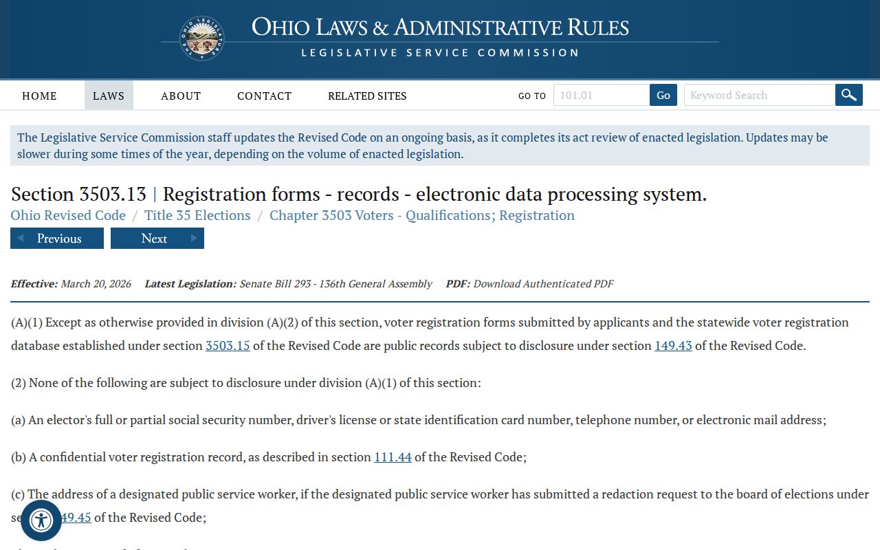
The statutory limits mean a map result should never be converted into a voter list, and protected registrations must remain protected.
The Mahoning County voter-information page provides the Board of Elections route for registration, polling-place, address-change, and election-record questions. For documented statewide files, the Secretary of State's DATA Act archive is the appropriate source, with its own date-range and delivery controls.
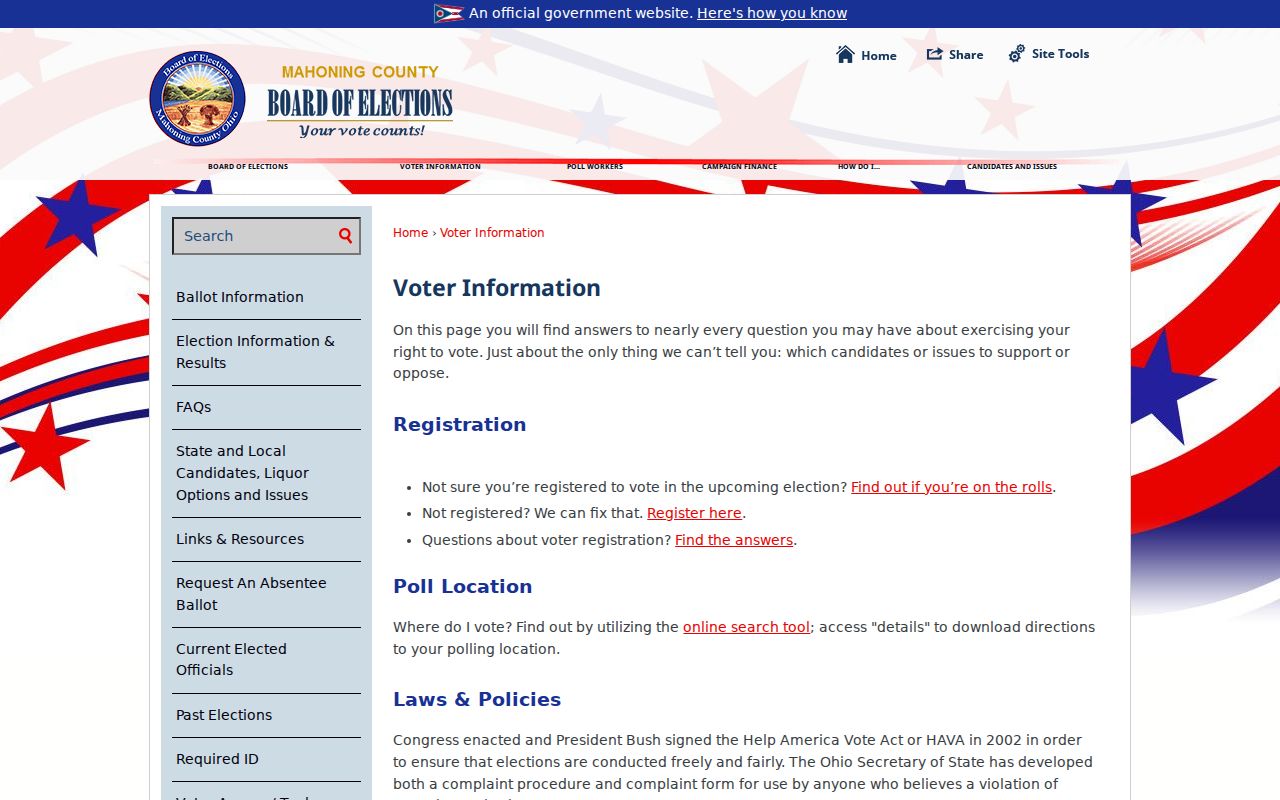
The Board is the human channel for a discrepancy or a request for a defined existing record, rather than an open-ended request to identify a block.
Youngstown Neighbors Community Contacts
The Youngstown Neighborhood Groups directory is the right community layer for a resident who wants a legitimate point of contact. It lists 30 groups and gives coverage, meeting, contact, or map details for their profiles. It does not publish membership rosters. That distinction makes the directory more useful for a block concern, cleanup, meeting, or neighborhood history question than for attempting to identify individuals.
| Community contact | Verified directory detail | Appropriate use |
|---|---|---|
| Wick Park | Profile provides contact and meeting information, with boundaries at Crandall Avenue, Madison Avenue Expressway, Fifth Avenue, and Andrews Avenue | Ask about a community meeting or coverage area |
| Lansingville | Listed among the City's neighborhood groups | Use the City profile's current contact route |
| Brownlee Woods | Listed among the City's neighborhood groups | Use the City profile's current contact route |
| Garden District | Listed among the City's neighborhood groups | Use the City profile's current contact route |
| Oak Hill | Listed among the City's neighborhood groups | Use the City profile's current contact route |
The City neighborhood-groups directory shows the official profile format and its community-focused contact layer.
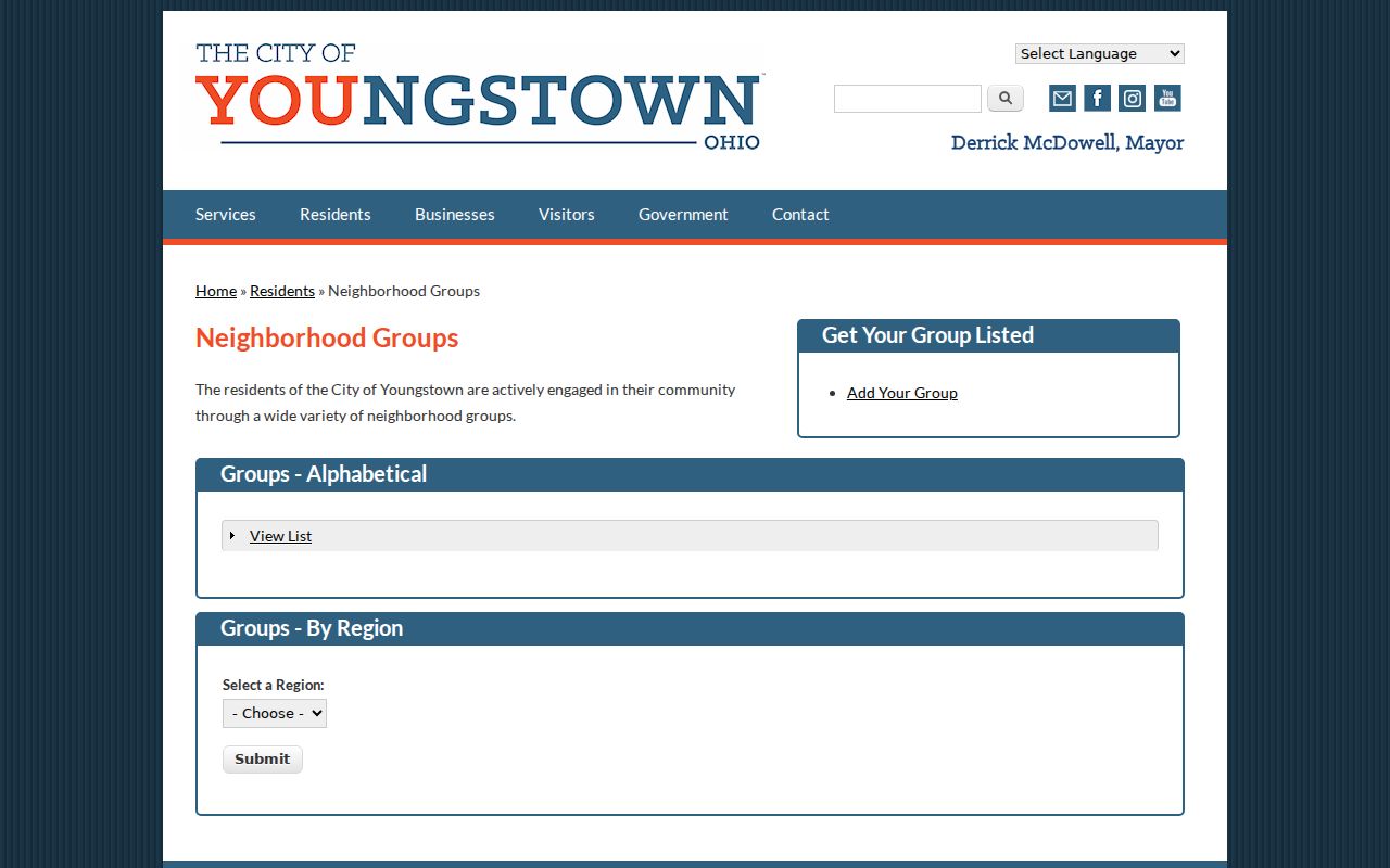
Use the listed coverage and contact information as the City presents it, and do not assume that a group profile identifies every person in its area.
Youngstown Neighbors in Old Directories
Historic neighbors require a dated source. Selected reverse or criss-cross directories at the Public Library of Youngstown and Mahoning County and Mahoning Valley Historical Society can lead from an old address to a directory-listed household head or business. The alphabetical edition then helps check occupation and household notation. In the digitized 1886-87 directory, the abbreviation key explains compact entries such as residence or boarding notation.
That entry proves only that a publisher placed a name at an address during that directory's compilation period. It does not prove legal ownership, an exact move date, current residence, or every person at the location. Use a parcel, deed, obituary, or the nearest released census record to test a historic directory result. The collection holdings and year-specific cautions are covered on the Youngstown city directories page.
Youngstown Neighbors Source Comparison
Official records and commercial neighbor-lookup categories serve different purposes. The official route names the custodian, gives field labels, and lets a reader check a parcel, document, or voter rule at the source. A commercial category may combine mixed public and commercial data, but it can be outdated, incomplete, or unclear about a result's original date. Neither category replaces lawful judgment or a direct community contact.
| Source type | Useful for | Core limit |
|---|---|---|
| Official parcel and map records | Parcel boundaries, dated property fields, and recorded land links | They do not supply a private household list |
| City neighborhood contacts | Coverage, meetings, and a legitimate community route | They are not membership directories |
| Commercial lookup category | A lead that must be checked with the original custodian | Accuracy, date, source, and lawful-use limits can be unclear |
When an official trail stops, ask the Auditor, Recorder, Board of Elections, library, or community group for the specific record or contact path it maintains. A broad request to locate people is not a substitute for that defined process.
Youngstown Neighbors Safety Boundaries
Questions about a threat, a false emergency, or a suspected scam are not block-directory questions. Ohio's records-misuse rules and the Attorney General's guidance point people back to verified government contacts. For an immediate threat, use 911. For a Youngstown police matter, the published nonemergency number is 330-747-7911. Do not confront someone based on a map, an old directory, or an unverified message.
The Mahoning County public inmate information interface is a county-custody source, not a neighborhood directory or proof of a person's residence.
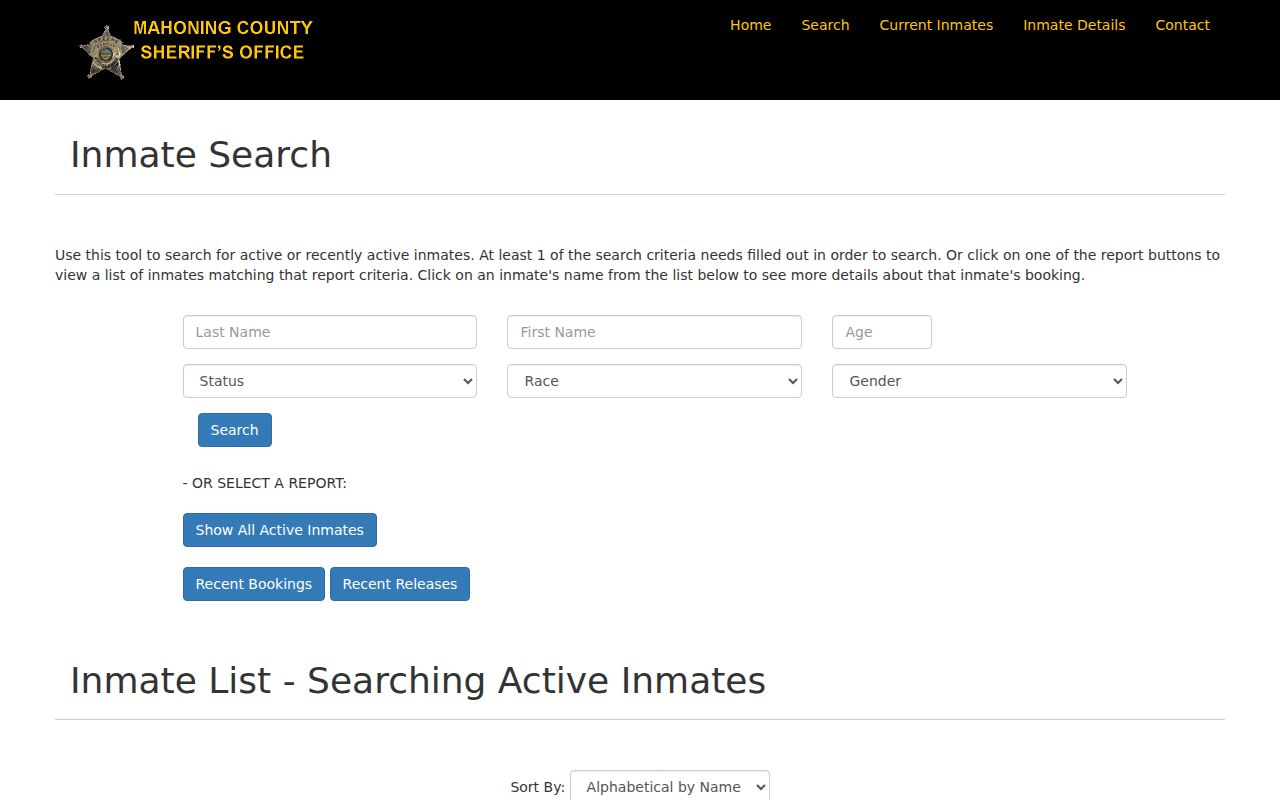
Any custody result can change rapidly and should be read only under the Sheriff's current access rules and its displayed status information.
A deed-copy or property-alert solicitation should also be checked with the official Mahoning Auditor or Recorder contact, not a payment link in the message. County property-fraud alerts announced in January 2026 are free, but the post-transfer program is notification rather than prevention.
Youngstown Neighbors Privacy Limits
Many details around a block stay private: unlisted occupants, utility customers, delivery information, protected Safe at Home voters, motor-vehicle personal information, sealed court material, and data not released by the custodian. Safe at Home gives eligible participants an address-confidentiality route, while ORC 111.44 addresses confidential voter registration. Ohio's online-redaction law also supplies a defined process for certain personal information. A public property card does not override any of those limits.
Use a precise correction path when a government record is wrong. Parcel issues belong with the Auditor, voter registration with the Board, and court entries with the Clerk or court. A commercial copy of a record is not the proper place to correct the official source. No map, voter match, or community profile grants a right to watch or contact another person.
Lawful use. Use Youngstown neighbors records for lawful personal research, community contact, family history, or safety awareness. Never use them to stalk, harass, intimidate, impersonate, or expose a protected person.
Note: Ohio laws on menacing by stalking, telecommunications harassment, and false emergency reporting can apply to qualifying misuse of identifying information.